
Google Maps is about to introduce a new "Immersive View for Routes" feature that will help the user gather information about traffic, bike lanes, complex intersections, parking, and more. The company announced this at the annual I/O conference, writes TechCrunch.
In the coming months, "Immersive View for Routes" will start working in 15 cities: Amsterdam, Berlin, Dublin, Florence, Las Vegas, London, Los Angeles, Miami, New York, Paris, San Francisco, San Jose, Seattle, Tokyo and Venice. It will be available on Android and iOS.
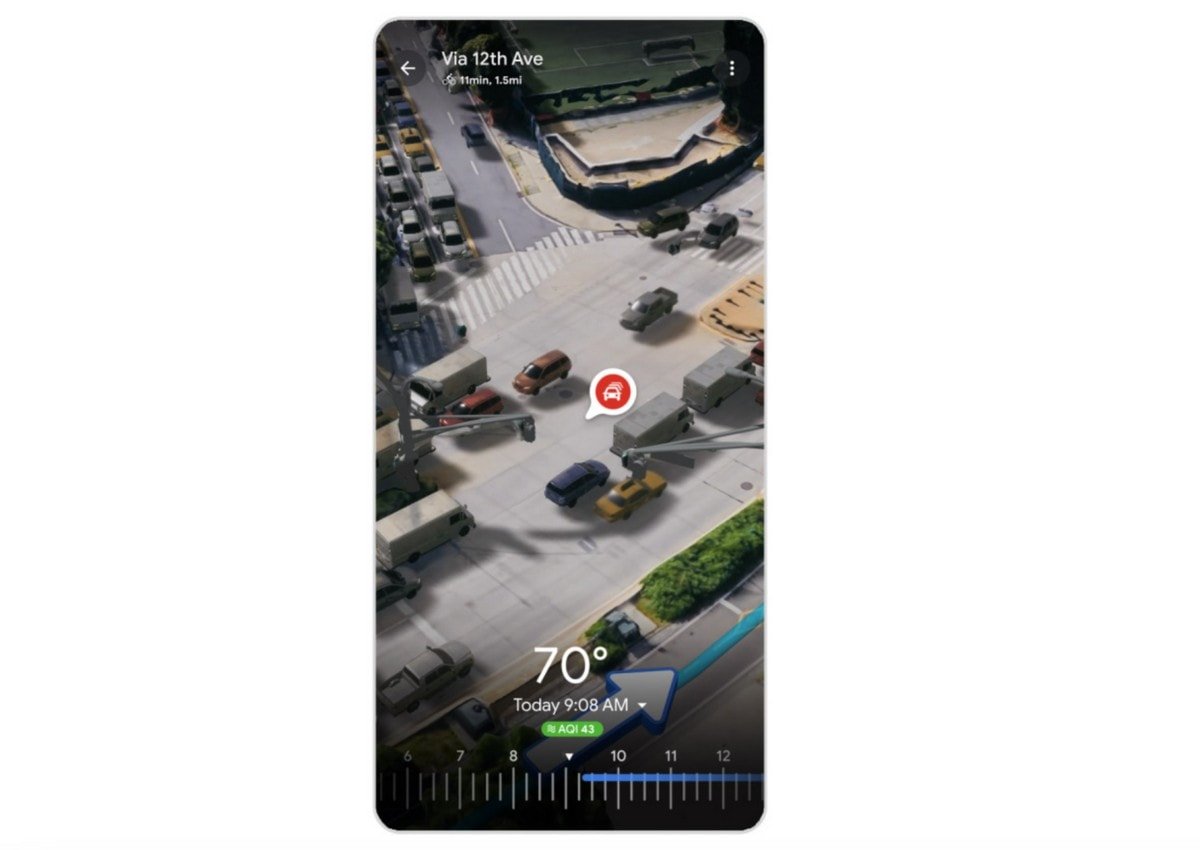
The feature is based on the "Immersive View" that Google first announced at I/O last year. Its purpose is to help plan a trip and get a deeper understanding of the city before the user visits it. Another important point is that "Immersive View" uses, in particular, artificial intelligence to combine billions of street images and aerial photos to create a digital model. "Immersive View for Routes" follows the same concept as it allows you to view and understand routes before a person drives them.
With Google's current and historical data about a certain area, the new feature lets you see what the weather might be like on a certain day, or what traffic might be like at a certain time. It also has a time slider to see air quality and route information throughout the day.
”Google Maps provides 20 billion kilometers of directions every day,” Google CEO Sundar Pichai said during the company’s keynote. “That’s a lot of trips. Imagine if you could see your whole trip in advance. With Immersive View for Routes, now you can, whether you’re walking, cycling, or driving.”
Google is also launching an Aerial View API for developers, which allows them to embed pre-recorded aerial video into their apps and websites to show what a place looks like visually. Additionally, the company is piloting Photorealistic 3D titles for developers to easily create custom, immersive maps and visualizations for their brand.
We remind you that Google continues to improve its services for use in electric vehicles and announced several new features for Google Maps. This applies to the Google Maps application, which is built into electric cars, including some models of Polestar, Volvo, Renault and cars of several brands of General Motors.