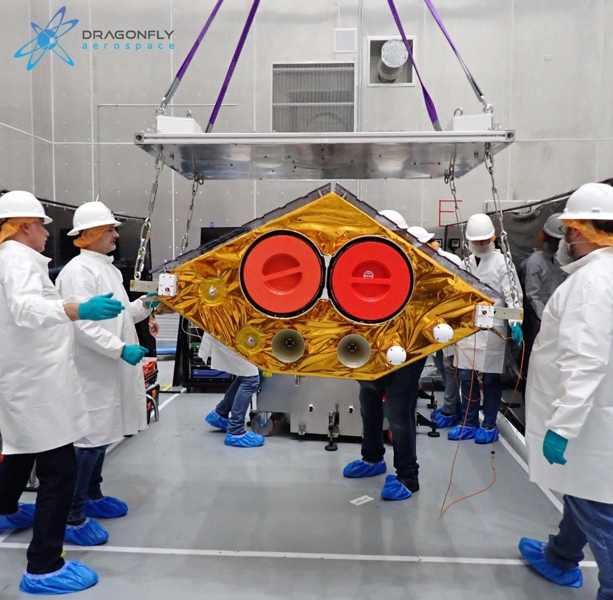
Mezha already wrote about going into orbit and the first communication session with the Ukrainian Earth observation satellite EOS SAT-1 of the company EOS Data Analytics. With the help of the EOSDA company, we had the opportunity to ask Andrii Muzychenko, the EOS SAT project manager, several questions about the new satellite and its mission.
Good afternoon, Andrii. First of all, we would like to congratulate you on the successful completion of the first phase of the construction of the EOS SAT satellite constellation. It is nice to know that such things are being done in Ukraine.
Hello and thank you very much! We in the team are very happy, it was a really exciting launch and the start of a new era for the development of EOS Data Analytics.

Before we get to the EOS SAT-1 itself, could you talk a little bit about EOS Data Analytics? When was the company founded, how many people are currently working at EOSDA? How are they distributed across the cities of Ukraine?
EOS Data Analytics (EOSDA) is a global provider of artificial intelligence-based satellite data analytics that operates worldwide and works with government, commercial and academic organizations. The company was founded in 2015 by Maksym Polyakov, an international space entrepreneur of technologies and IT, follower of Vernadsky's Noosphere theory and founder of the Noosphere project group.
EOS Data Analytics has more than 200 employees, including a highly focused Science Unit:
GIS specialists: analysts of geospatial data and information that can be obtained from remote sensing of the Earth (RS) data. The main role: data extraction of remote sensing of the Earth with the help of profile GIS packages, libraries, and tools developed in-house, as well as cataloging, structuring, and data analysis.
Data Science/Data Engineering: Scientists and professionals who build and train neural networks using machine learning and artificial intelligence technologies. Algorithms are also being created to solve such tasks as determining zones of illegal logging.
The main office of the company is located in the USA. The R&D team works from Ukraine, namely we have offices in Kyiv and Dnipro.
And the question is catching up. How does EOS Data Analytics adapt to air alarms and power outages?
The offices in Kyiv and Dnipro are equipped with generators, Starlink, and heaters in case there are also heat outages. Some employees moved to Kyiv from other regions of the country. Offices are open for those who have power outages - we also call them hubs (these are our unbreakable points). During air alerts, the team has Internet access, snacks, water, and tea in the shelters, where workplaces are equipped.
Where will the EOS SAT Constellation Control Center be located, in Ukraine or in South Africa?
The flight control center is located at Dragonfly Aerospace's office in South Africa. The company intends to make this center responsible for all its future satellites.
As I understand it, there used to be a division of labor in the satellite analytics market. Some companies supplied satellite images, while others analyzed them? Why did you decide to hack this system? When did you realize that you need to have your own satellite group?
Our goal is to provide farmers not only with a holistic picture of what is happening in the fields but also with a comprehensive analysis of the factors that affect the normal development of plants, as well as tools to solve problems that can threaten the harvest.
To achieve this goal, we conducted extensive research, studied market needs, and analyzed open-source satellite data gaps. So we realized that in order to ensure the highest quality of our analytical products, we need access to unique data that can only be obtained from satellites that meet certain criteria. We did not find such satellites and decided to create our own.
At the same time, not only EOS Data Analytics is working on the EOS SAT satellite group. In particular, our technology partner from the Noosphere project group, Dragonfly Aerospace, is directly engaged in the construction of satellites, so the division of labor is still present.
However, by launching our own group of satellites, we aim to create a complete vertical of analytics production from the direct acquisition of images to their processing, analysis, and delivery to ensure the accuracy and relevance of our data.
On the EOS Data Analytics website, it is indicated that in addition to the control of agricultural land, your company provides services in many other applied fields. Could you name some of them?
Indeed, although we are focused on agriculture, we are not limited to it. Since 2020, we have been expanding our spheres of activity. Our R&D department is actively working on potential use cases of data from EOS SAT satellites for marine industry. In particular, it is about observing the oceans - measuring water height and surface temperature, analyzing the color of the ocean and tracking the movement of water, monitoring the weather.
And in 2021, we launched EOSDA Forest Monitoring – software for management of forestry based on satellite data.
With the help of satellite images, the software allows landowners, logging companies, research institutes and other organizations to remotely monitor the state of the forest, have access to the most current data on forest assets online, receive notifications of changes and possible risks by email and manage all their forest areas in one place.
How exactly does AI help analyze and/or improve the satellite photos that EOSDA works with?
For a number of solutions, we use technologies based on neural networks. For each specific solution, we build a machine learning model that learns on data relevant to a specific task. For example, in EOSDA Forest Monitoring, a forestry management service based on satellite data, a machine learning model is used to detect logging, forest monitoring and restoration in areas of interest.
Since we work with satellite images, our work uses convolutional neural network (CNN) architectures that are designed to work with images. Various CNN and ConvLSTM models are used to solve classification and regression tasks.
On the example of EOSDA Crop Monitoring, an online satellite field monitoring service for precision farming: using Sentinel-2 satellite images, artificial intelligence in the software enables a large amount of important crop status information to be combined on one platform, making field management much easier for the user.
Where are your customers? USA, South Africa, Europe, Australia? Do any Ukrainian farmers, agricultural holdings or forestry companies use such modern technologies?
We provide geospatial solutions to clients in all 195 countries, from Madagascar to Paraguay. More than 950,000 users around the world make decisions based on our data.
Ukraine has been EOSDA's home country since its inception, making it one of the key regions for us. Among the most important players with whom we cooperate here are farmers, agricultural holdings, agricultural consultants, state institutions, and suppliers of plant protection products.
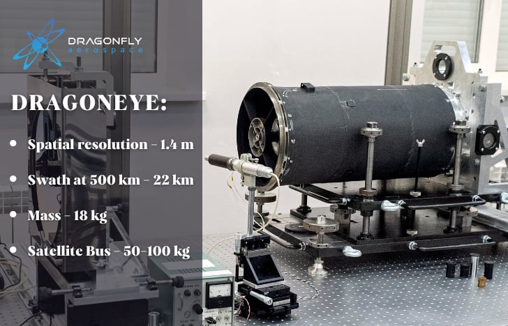
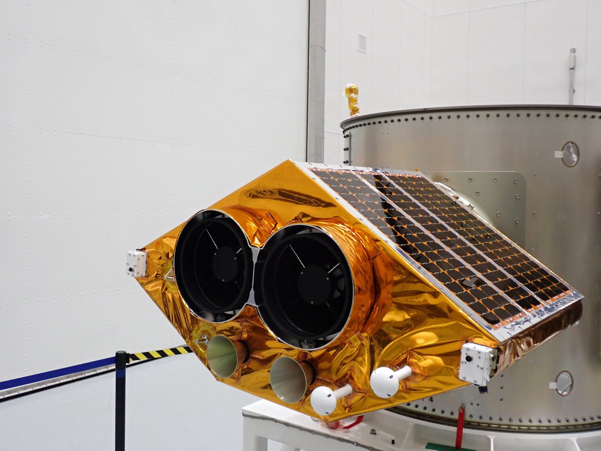
EOS SAT-1 is equipped with two DragonEye cameras from Dragonfly Aerospace, but the company also has more powerful Raptor cameras with twice the resolution. Why was DragonEye chosen, is it related to the weight and size characteristics?
In fact, the resolution of DragonEye is quite sufficient for the needs of EOS SAT satellites in agriculture. In addition, we could install these cameras right here and now: they were already at the production stage.
When we need to understand what's happening at the field, country or regional level, we don't need a finer resolution. It is more than enough for analysis of the condition of crops according to vegetation indices and control of forest areas.
In addition, a higher resolution will increase the physical volume of images, the load on the company's infrastructure, and the cost of the service for the end user.
In addition, I would like to clarify some characteristics of space cameras for the average reader. What is the difference between PAN and MS spatial resolutions? Swath, as I understand it, is a strip of capture of the Earth's surface from a certain height? By the way, what are the current parameters of the EOS SAT-1 orbit?
The constellation will consist of seven satellites providing high-resolution panchromatic (PAN) and multispectral (MS) imaging. To understand what is physically happening in the desired area, a panchromatic image is needed, and to analyze the image from the point of view of vegetation and the condition of crops in agriculture, a multispectrum is needed.
Panchromatic images are always black and white, because they combine information from red, green, blue, and other channels, but at the same time, thanks to this combination, they are bright enough and have a high resolution. Multispectral images can be less detailed, but allow tracking of the unique spectral characteristics of objects. For example, with them, you can notice a lack of nutrients or the appearance of pests on agricultural crops.
For a clearer visualization, at the stage of processing the obtained images, pansharpening is performed, that is, combining panchromatic and multispectral images to obtain both high resolution and spectral attributes necessary for studying a certain problem.
As for Swath, yes, in our case it means that the total width of one picture is 42 km, and the length can reach more than one thousand kilometers. Regarding the parameters of the satellite's orbit, we can say that the height of the sun-synchronous orbit of EOS SAT-1 is 520-560 km.
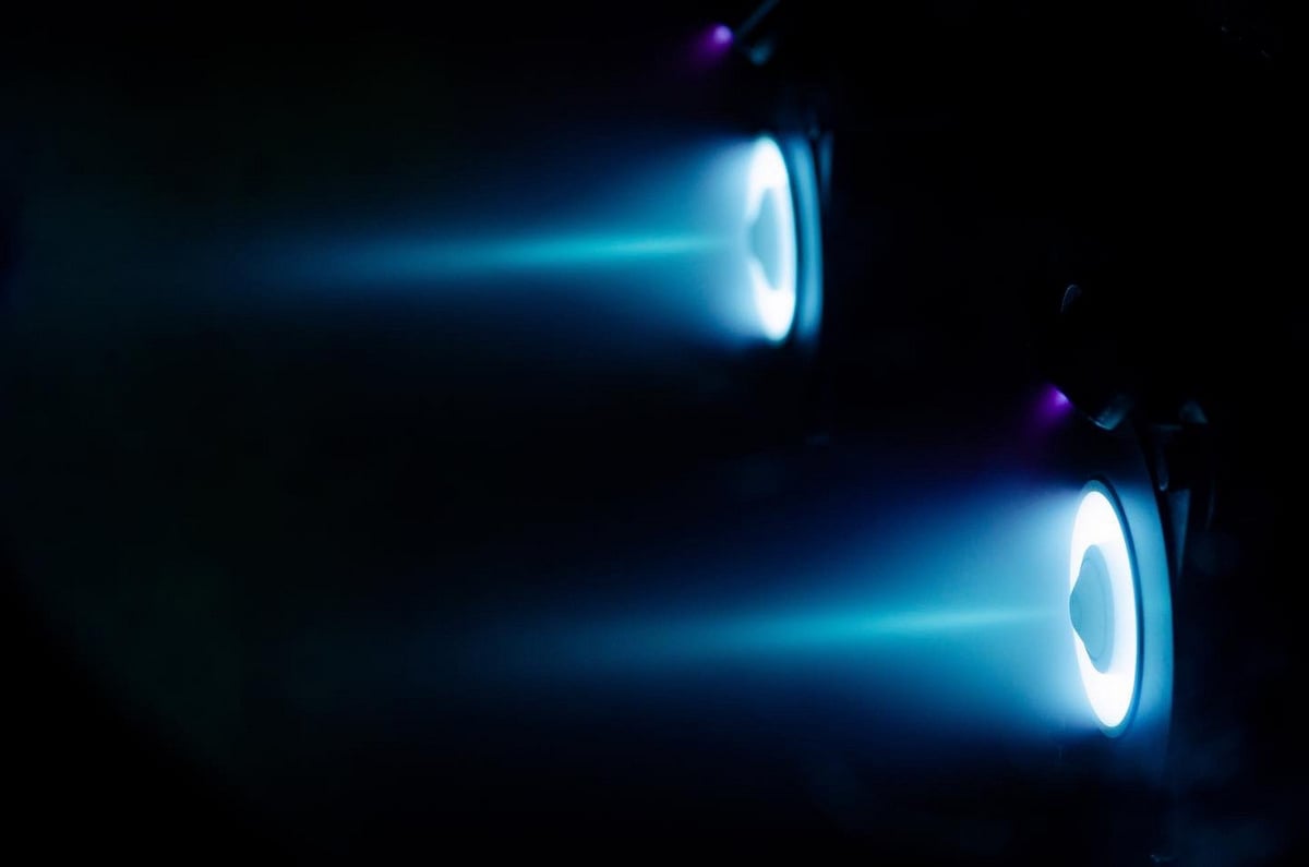
EOS SAT-1 is equipped with Hall-effect electrostatic plasma thrusters manufactured by SETS (Space Electric Thruster Systems) from Dnipro. What are the advantages of such thrusters?
Classic engines used to launch rockets into space burn a lot of fuel and work for a short time, but give a lot of energy. In contrast, ion thrusters do not burn fuel, but use electrostatic plasma effects and can operate with less power for longer and more economically. Because of this, we can use them for maneuvers in orbit, and we do not need super-powerful engines.
You are going to launch 7 satellites by 2025, but as I understand it, you can start working now, with one satellite. And in general, what is the planned lifetime of a separate satellite of your group?
Of course, soon the data of the first satellite will be available to our users. After launch, the satellite will undergo a 3-month testing period before it becomes fully operational. So we plan to deliver the first EOS SAT-1 satellite images to customers in April 2023.
The lifetime of one satellite is 5 years, with the possibility of extending the period of operation, provided that operational efficiency and fuel reserves are maintained on board.
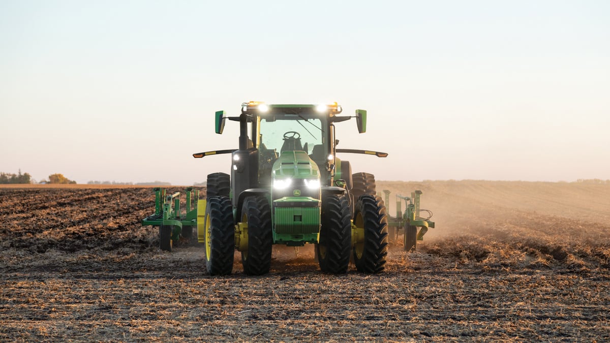
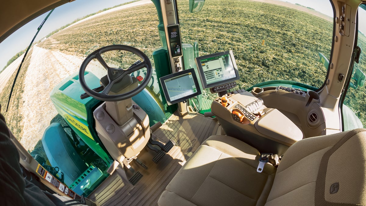
Previously, science fiction writers, and now scientists are insisting that the survival of humanity depends on how quickly we introduce full automation of agriculture with the involvement of ground and aerial agricultural drones, satellite systems, and AI. As I understand it, what EOS Data Analytics does is one aspect of solving this problem. Will automated farm machines, say, John Deere, be able to use your data? In general, how quickly do you think agriculture will be automated, at least if we talk about large farms?
Indeed, I foresee a complete digitalization of the agricultural sector, where everything is interconnected, and sustainable development is the basis of such interaction. Automation will make it easier to get food and grains to people's tables. It will also help to standardize products and ensure their repeated production throughout the year.
Even now, agricultural machinery of the professional class can perform many operations in automatic mode. In developed countries, automation already reaches 60-70%, where a person only controls the processes. As for developing countries, I think this is a matter of 20-30 years.
I am sure that automation will progress because cultivated areas are reduced, soils are depleted, and the population is growing. And that's why we have to increase the yield from each hectare.
I would like to add that a person will never disappear from the agricultural production cycle, because from time to time the equipment fails, and a person must connect and make certain decisions.
EOS SAT will primarily help monitor large areas and detect deviations from crop growth or crop degradation. It is much easier and more convenient to first get a complete picture of all territories from space, and then send a scout to the area where the deviation was detected by the satellite. A scout on site will be able to understand the situation in more detail with the help of a drone or a visual inspection.
And finally. How to get a job at EOS Data Analytics to manage satellites? What specialists are you looking for?
We are always looking for professionals to help us bring space closer to people and make their lives easier with faster and more informed solutions. For example, we are currently looking for specialists in the design, sales, and customer success teams. You can view our open company vacancies here.
Thank you for the answers, Andrii, good luck with your business. We are waiting for the first images of EOS SAT-1 and new launches!